Canada – Floods Destroy Roads, Force Evacuations in British Columbia
Source:floodlist.com
High levels of rain since 14 June 2016 have caused major flooding in the Peace River Regional District in northeastern British Columbia, Canada.
Dawson Creek and Chetwynd, around 100km west, are two of the worst hit areas. Evacuations have been carried out and flooding has caused severe damage to roads and infrastructure. However, no injuries or fatalities have occurred.
On 15 June, the Mayor of the District of Chetwynd declared a state of local emergency within District of Chetwynd boundaries as a result of the floods. According to Environment Canada, 79 mm of rain had fell in Chetwynd by noon on June 15, 2016.
“We all need to take measures to ensure our families, structures and livestock are safe at this time,” stated Mayor Merlin Nichols.
In Dawson Creek, 60 residences were evacuated due to flooding from the creek that cuts through the centre of the city, said Mayor Dale Bumstead.
Roads and Bridges Damaged
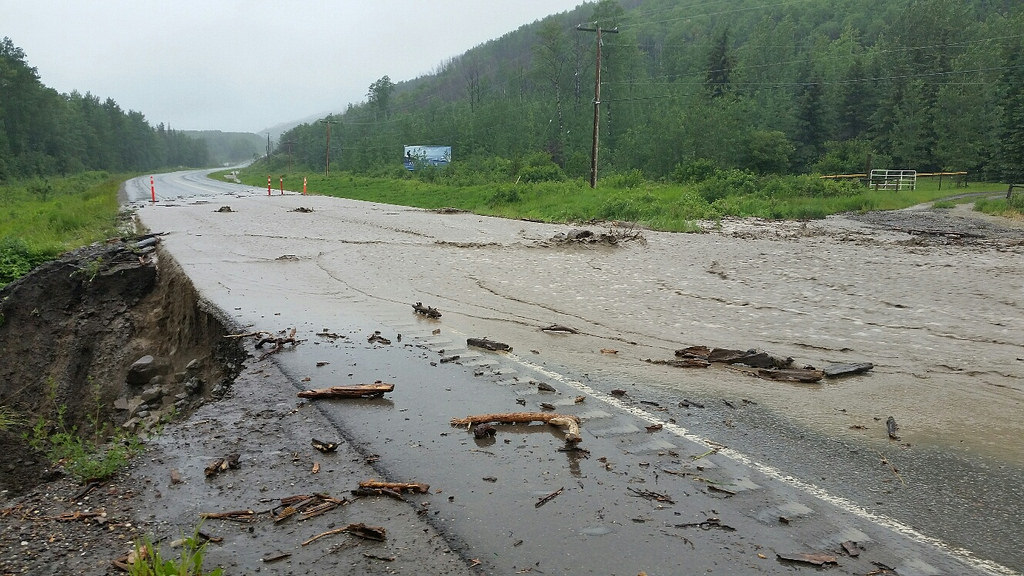
Flooding has washed out major roads and bridges, and damaged powerlines. British Columbia Ministry of Transportation said that the heavy rain had caused rapid increases in water levels in streams in the Peace region. Some of the highest rainfall totals were recorded near Pine Pass, Chetwynd and southeast of Fort Nelson.
They added that “Flooding and washouts have significantly impacted many roads in the area. Wide spread flooding is making travel hazardous on highways and local roads throughout the region. Unnecessary travel in the region is not advised. Impacted communities are Dawson Creek, Chetwynd, Fort St. John, Fort Nelson. Crews are on scene, working to restore access.”
Rivers and Flood Warnings
The British Columbia River Forecast Centre said yesterday that Flood Warning remains in place for the Peace Region including streams near Pine Pass, Chetwynd, Tumbler Ridge, Dawson Creek, and Fort St John. A Flood Watch is in place for Northeast BC including streams near Fort Nelson.
The River Forecast Centre said yesterday that the Pine River near East Pine is recording a flow of 3116 m3/s, which exceeds the 20-year return period flow. Water levels increased 145 cm overnight (15 June) and have been steady this morning. Flows are forecast to remain high Thursday between 3000 and 3500 m3/s, and will decrease on Friday.
The Sukunka River is recording a flow of 845 m3/s, which exceeds the 20-year return period flow. Water levels increased 30 cm overnight and have begun to decrease this morning. Flows are forecast to decrease through Thursday.
Rainfall Totals
The following is a summary of unofficial storm total rainfall amounts in mm as of 06:00 Thursday 16 June 2016, according to Environment Canada.
Chetwynd: 129.6
Lemoray: 114.0
Dawson Creek: 105.6
Link Creek: 75.4
Braden Road: 91.5
Mackenzie: 51.7
Fort St. John: 55.8
Photos of Floods in northeastern British Columbia, Canada, June 2016

 Dawson Creek floods, British Columbia, Canada, June 2016. Photo; City of Dawson Creek
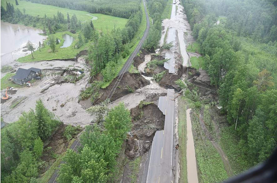 Floods have caused major damage to transport in Peace River Regional District in northeastern British Columbia, Canada. Photo: BC Ministry of Transportation, CC BY-NC-ND 2.0
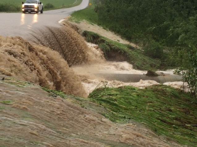 Mason-Semple Road Near BC Highway 97, June 2016. Photo: British Columbia Ministry of Transportation, CC BY-NC-ND 2.0